
Snow Rooftop Mapping
Project overview
In 2019, the Geospatial Core Facility launched an initiative to address snow-related structural risks on campus using advanced geospatial technologies. By integrating rooftop snow-scale data, drone-based lidar imagery, and sophisticated mapping tools, the team developed a comprehensive snow load monitoring system. This solution enables real-time analysis and visualization of rooftop conditions, providing facilities teams with the actionable insights they need to prevent future incidents and ensure campus safety during extreme winter events.
This cutting-edge monitoring system exemplifies the power of geospatial science in solving real-world infrastructure challenges. Designed to be both scalable and replicable, the project delivers an intuitive digital platform that allows facilities personnel to anticipate risks and respond with greater efficiency. The initiative also serves as a hands-on training opportunity for emerging GIS students.
Geospatial Core Facility in action
|
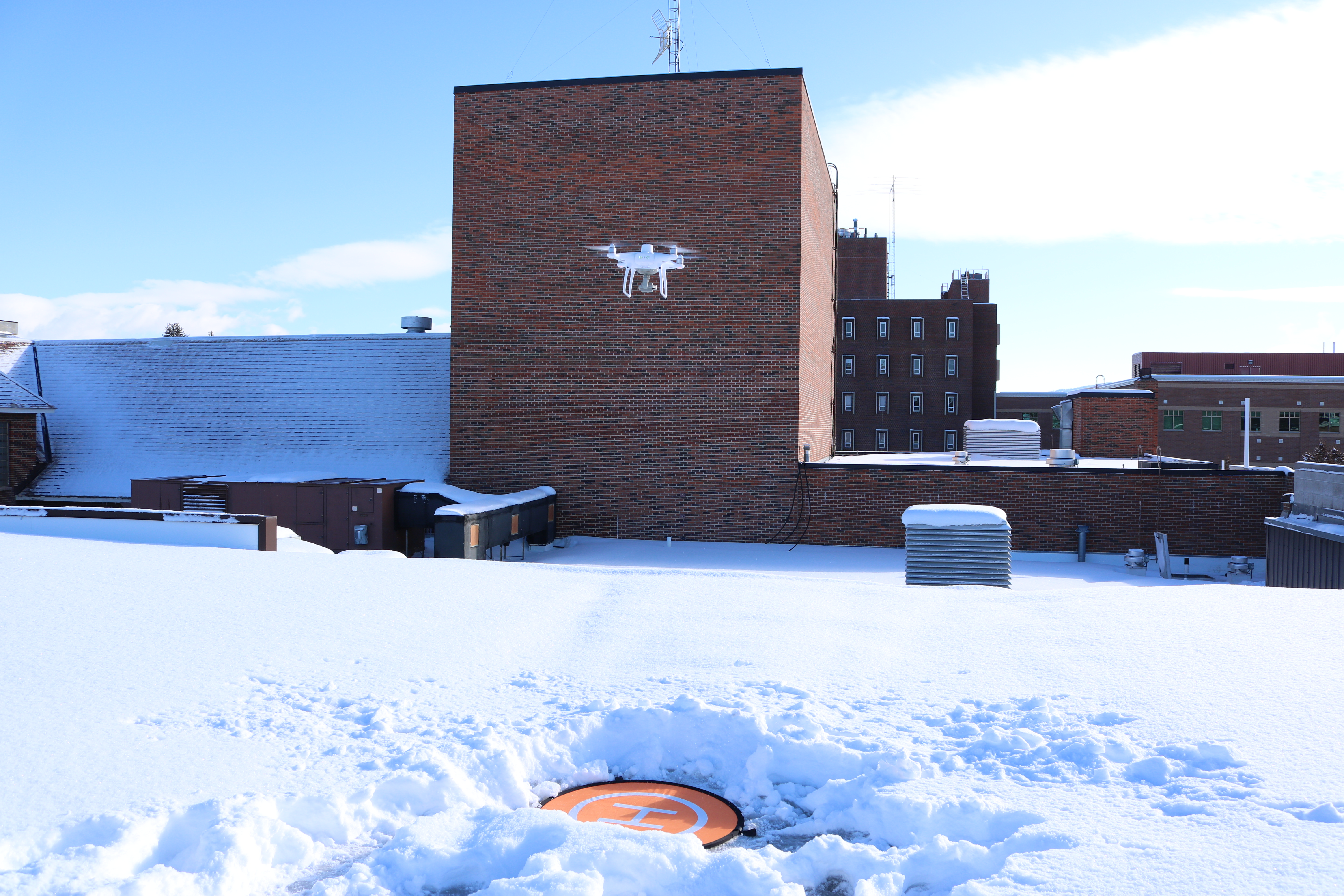
Drone flight on a MSU rooftop. |
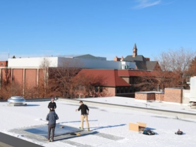
Mapping out the snow coverage on MSU rooftops. |
Tools in action:
|
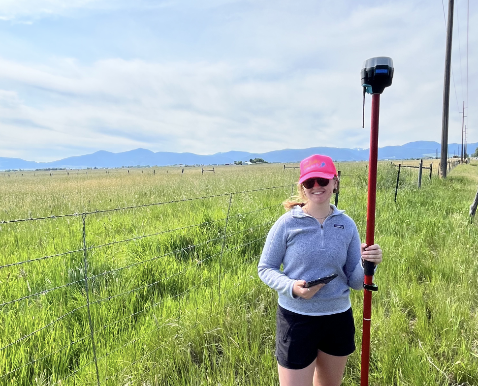
Emlid GPS measurment marks accurate locations for ground trouthing. For more information have a look at our our Technology and Tools section. |
|
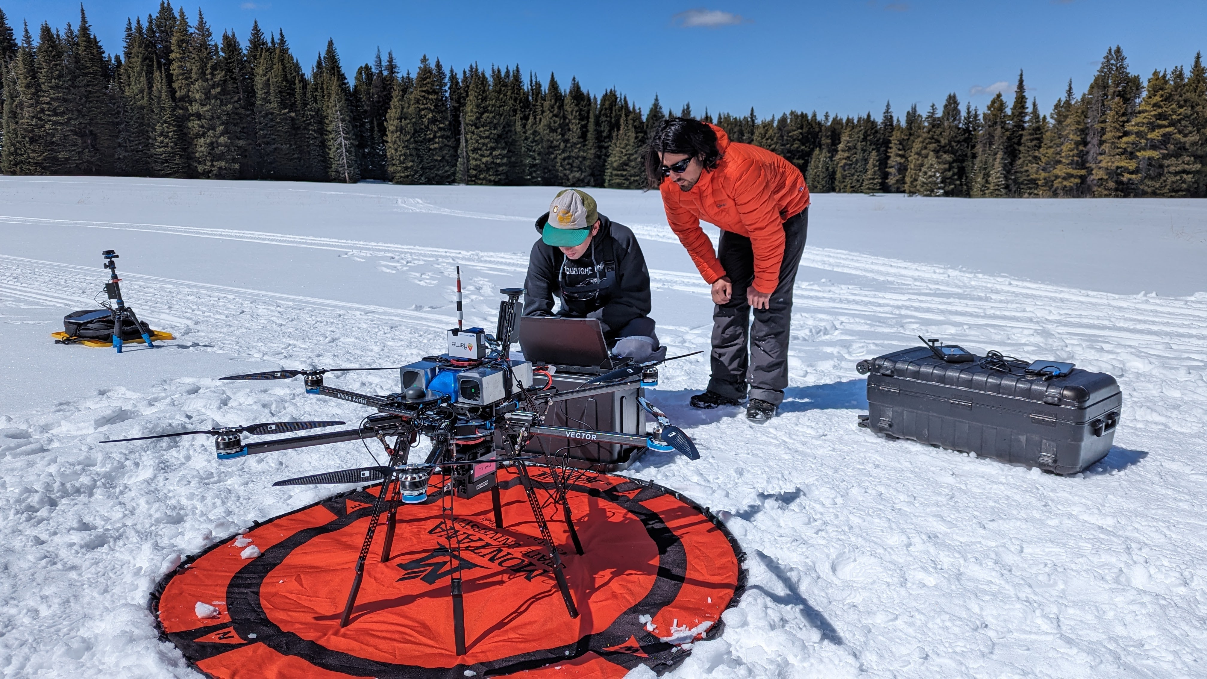
The Vision Aerial Vector is a powerful drone able to carry heavy load like sensors and batteries. For more information have a look at our our Technology and Tools section. |
|
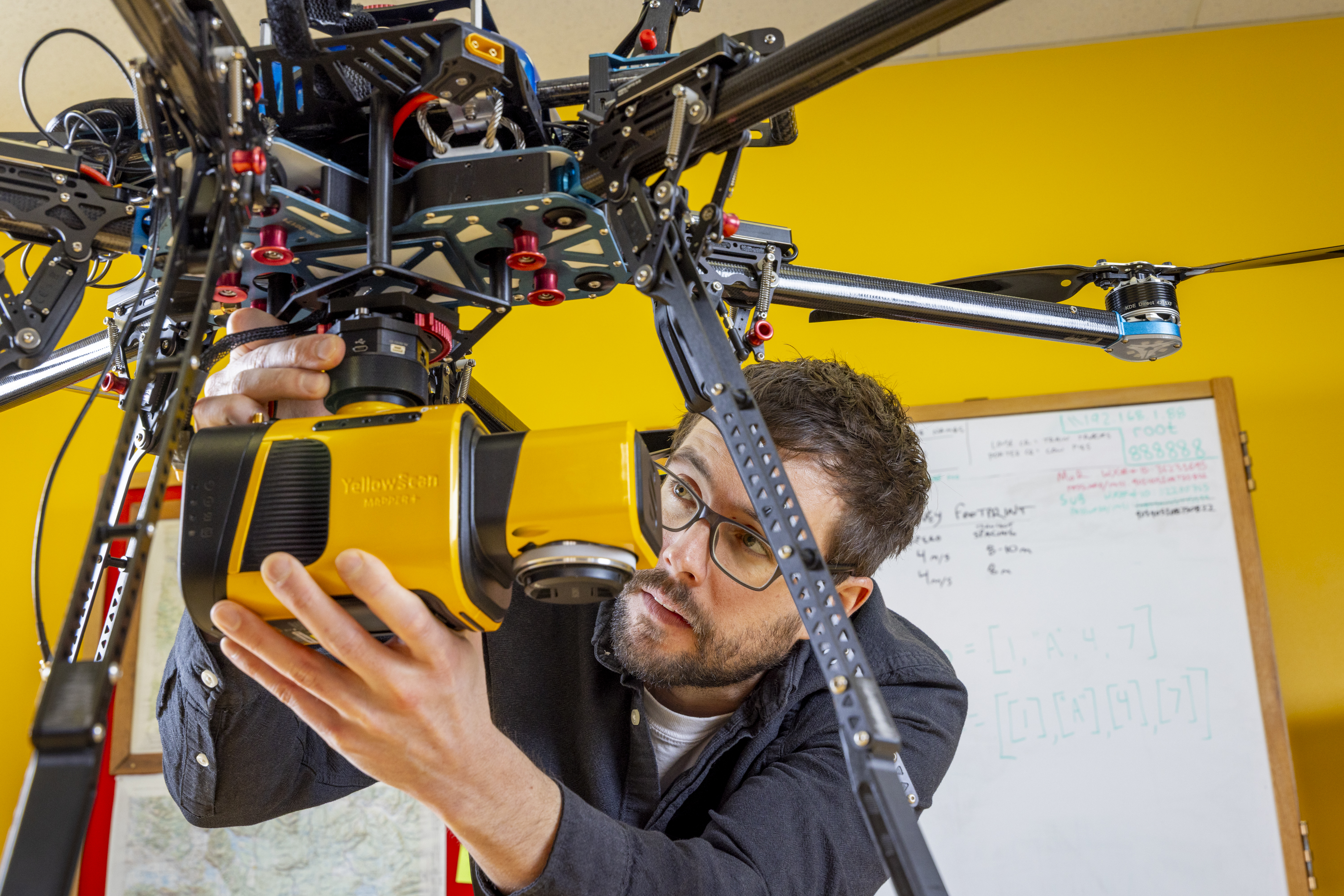
The YellowScan Mapper+ is a UAV-mounted LiDAR Scanner. For more information have a look at our our Technology and Tools section. |
More information on the project
Further information on the rooftop snow‑load monitoring project can be found in the Esri ArcWatch article “Students Take on Snow with GIS”, which outlines how Montana State University students and faculty used LiDAR, snow‑scales, ArcGIS Pro, and Experience Builder to map snow depth, density, and load.