
River Conditions Tool (RCT)
Project overview
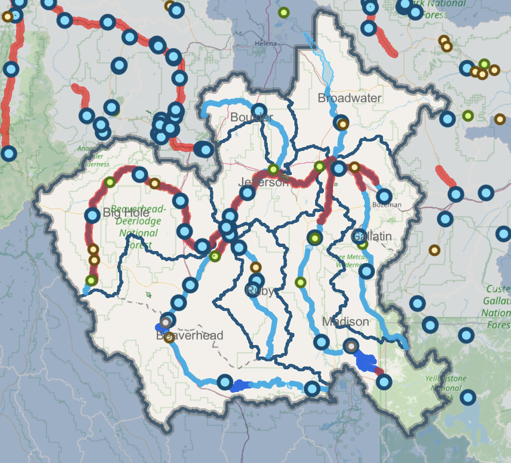
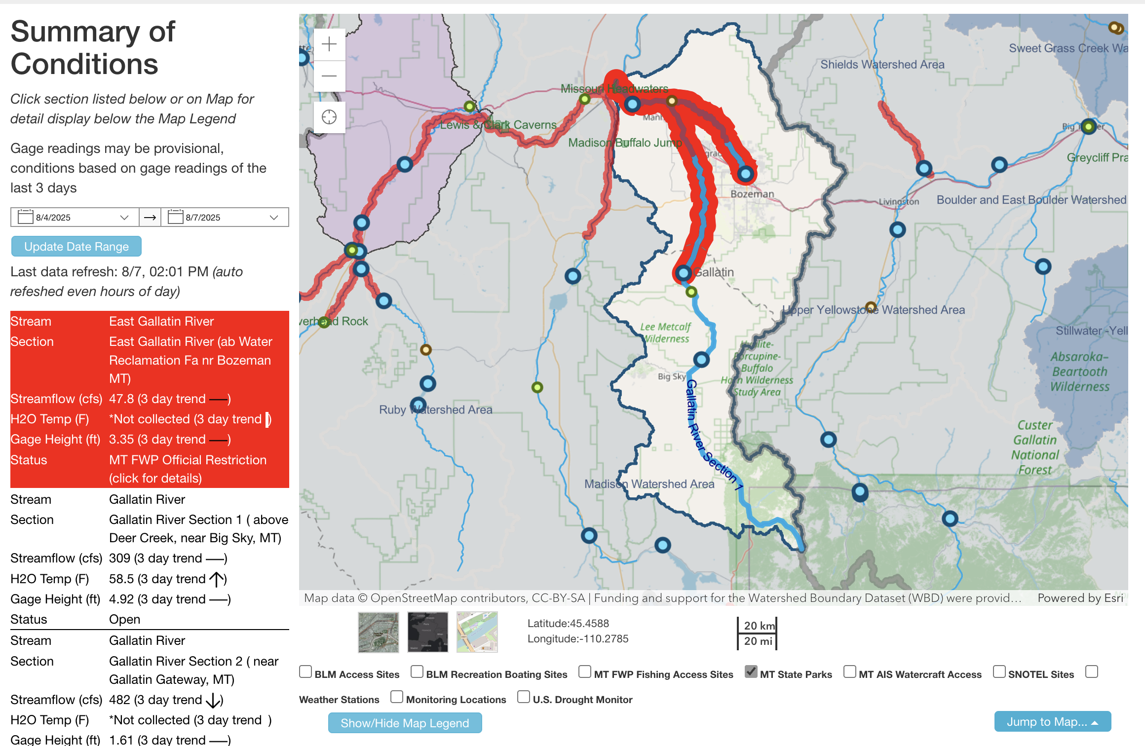
The River Conditions Tool (RCT) provides easy access to real-time river conditions data, angling and water-use alerts, interactive data charts, public river access sites, and much more. The RCT is publicly accessible on a phone, tablet or computer with an internet connection.
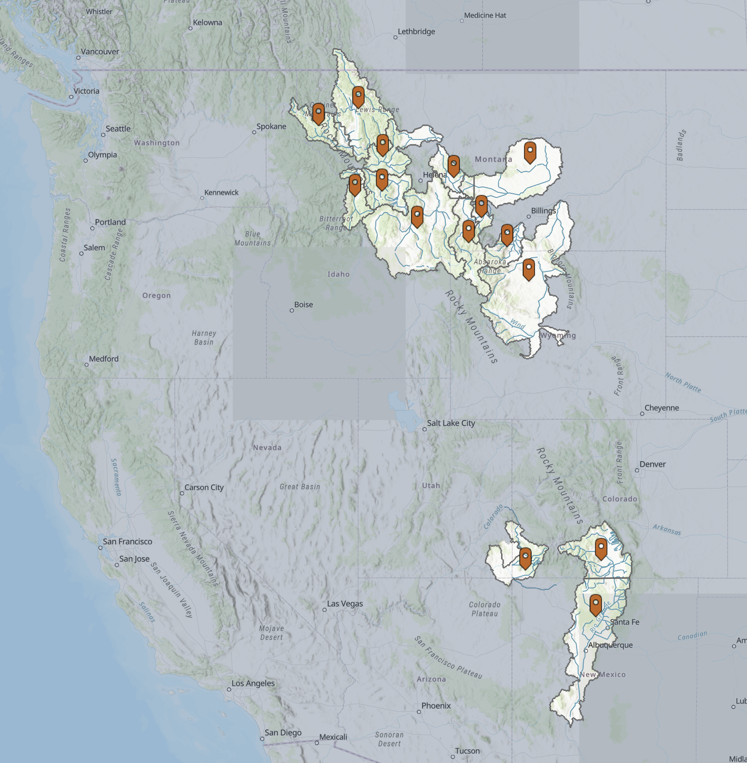
In 2018, the Montana Department of Natural Resources Conservation and U.S. Fish and Wildlife Service identified a need for Upper Missouri Headwaters watershed groups to have access to stream flow and stream temperature data for conservation and drought planning. In partnership with the watershed groups of the Upper Missouri Headwaters, Environmental Protection Agency, Montana State University, and Montana Institute on Ecosystems, they developed the River Conditions Tool.
Geospatial Core Facility's contribution
|
|
|
Screenshot of the online RCT. |
More information on the project
The idea and process of improving the access to river conditions for water users is summarized in a story map that can be accessed through the following link:
Storymap on River Conditions Tool
Project partners
The River Conditions Tool is the result of a collaborative effort among organizations committed to enhancing conservation and drought preparedness.
Launched in 2019, the River Conditions Tool was developed through the partnership and expertise of the following organizations:
-
U.S. Fish and Wildlife Service (USFWS)
-
Montana State University (MSU) - Geospatial Core Facility
-
Montana Department of Natural Resources and Conservation (DNRC)
-
37 Watershed Groups, and 59 Geographies
-
Montana Institute on Ecosystems (IoE)
-
U.S. Environmental Protection Agency (EPA)
Since its initial launch, the River Conditions Tool has expanded to serve additional regions and continues to grow through new partnerships and collaborative innovation.