
City of Bozeman Open Channels Remapping
Project overview
In 2021, the City of Bozeman partnered with the GCF team to remap open channels both within and beyond city limits, with early support from key stakeholders including the National Park Service.
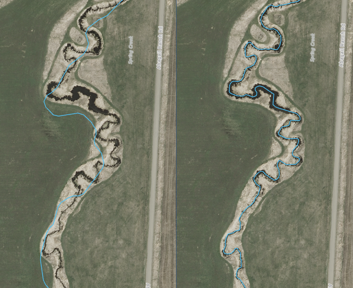
The most recent phase, completed in June 2025 in collaboration with the City of Bozeman Stormwater Division, marked a major milestone in the effort. To date, the project has successfully remapped over 370 kilometers (230 miles) of open channels, combining on-the-ground verification with precise digital edits informed by high-resolution imagery and LiDAR data delivering an unprecedented level of accuracy and detail.
Geospatial Core Facility's contribution
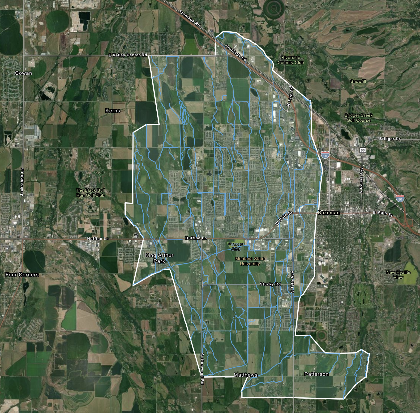 |
| Project goal: remapping open channels in and outside of city limits of the City of Bozeman. |
|
|
| The GCF remapped over 370 kilometers of open channel remapping, using ground truthing techniques and digital edits based on high resolution imagery and LiDAR data. |
Additional collaborators
- Gallatin Watershed Council
- National Park Service
- The Association of Gallatin Agricultural Irrigators