
Urban Growth Boundary Policies: A Balancing Act between New Development and the Preservation of Agricultural Land and Open Space
Part 2 (Series that examines urban growth boundaries)
May 12, 2026
By Justin Gallagher
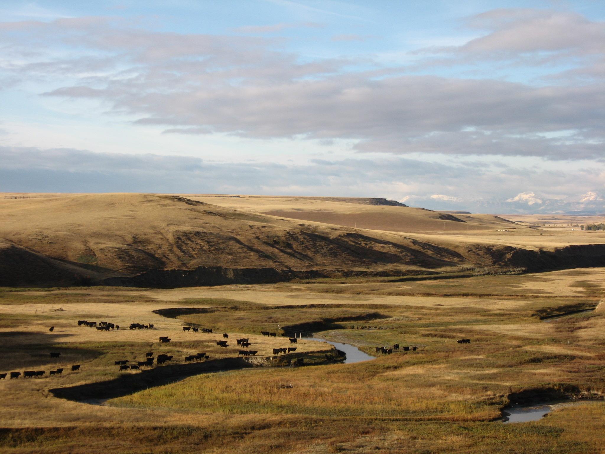 Source: MSU Externsion, photo by Sheron Curry
Montana is currently grappling with the best way to balance new housing construction for a rapidly growing population, while at the same time, preserving the undeveloped
beauty of the state. Urban Growth Boundaries (UGB) are a type of local land use regulation
that seeks to help strike this balance. UGBs encourage denser development near existing
urban areas and restrict development in locations farther away from cities and towns.]
Dr. Daniel Bigelow at Oregon State University and I are leading a multi-year research
initiative on UGBs. This is the second post summarizing our ongoing work examining
the impact of UGBs (1st post). Our research seeks to better understand how UGBs impact the short- and long-term
geography of development. In this post, I highlight key institutional features of
Oregon’s UGB policy and introduce our modeling framework.
Oregon provides a real-world laboratory to measure the impact of UGBs. Oregon’s UGB
policy is a defining feature of the state’s approach to urban planning and development.
The Land Conservation and Development Commission established the state’s planning
goals in 1976. These goals cover a variety of overlapping issues, including urban growth, housing supply, and
forest and agricultural protection. Oregon’s UGB policy is motivated by Goal 14: “To provide for an orderly and efficient transition from rural to urban land use, to
accommodate urban population and urban employment inside urban growth boundaries,
to ensure efficient use of land, and to provide for livable communities.”
Oregon’s UGB legislation came into effect in 1980 and applies to all incorporated
cities and towns. Each UGB includes the entire city, as well as additional unincorporated
county land. The UGB itself does not establish specific zoning or land use restrictions.
Rather, it formally specifies the land available for development at urban densities.
Oregon’s legislation stipulates that UGBs should expand over time to satisfy housing,
and infrastructure needs due to population growth.
We chose Oregon as our study area for several reasons. Oregon is a Western state with
a fast-growing population and similar demographics to Montana. The 45 post-policy
years provide the opportunity to examine both immediate and longer-run impacts. Moreover,
since all cities and towns in Oregon enacted the UGB policy at the same time, we can
examine how the effects of the policy differ based on characteristics such as city
size and local economic trends prior to the policy. Finally, there are data and statistical
modeling advantages of using Oregon as a laboratory to examine the causal development
effects of UGBs.
A well-known challenge in studying regional economic development is how best to draw
policy conclusions from observational data. Unlike the natural sciences, researchers
typically do not have the advantage of implementing scientific experiments with carefully
designed treatment and control groups. In recent decades, economists and statisticians
have made great strides in establishing new statistical models to work with observational
data. The 2021 Nobel Prize in
Economic Sciences was awarded to three researchers who pioneered many of these models. In particular,
the Nobel Prize highlights advances in causal analysis using observational data.
We use the exact placement of the UGB as a type of localized experiment and zoom in
on how development changes very close to either side of the boundary. (This type of
statistical model is more formally described here.) Our analysis requires detailed, comprehensive development data on both sides of
each city’s UGB boundary (see 1st post), and confidence that there are no other factors related to development that diverge
right at the boundary. For example, if the UGB boundary coincides with a river, then
this modeling approach would not isolate the causal effect of the policy. The fact
that all cities and towns were compelled to adopt a UGB policy by a specified date,
and that the Land Conservation and Development Commission approves the boundary locations
based on policy criteria, make it less-likely that the UGB boundaries are manipulated
by local officials in ways that undermine the applicability of the statistical model.
Our large spatial database allows us to confirm that geographic land features such
as slope, elevation, and soil quality are similar on both sides of the boundary.
This post concludes by showing motivating evidence that the Oregon UGB policy leads
to both a reallocation of where new development occurs and denser development inside
the UGB boundary.
Figure 1 plots the number of buildings per acre in relation to the location of UGB
boundary (vertical dashed line). The data are aggregated over all the cities and towns
in Oregon. Distance on the x-axis is relative to the UGB. Farther to the right is
closer to the city center. The figure plots the development densities for four different
time periods: two pre-policy years (1950, 1970) and two post-policy years (2000, 2020).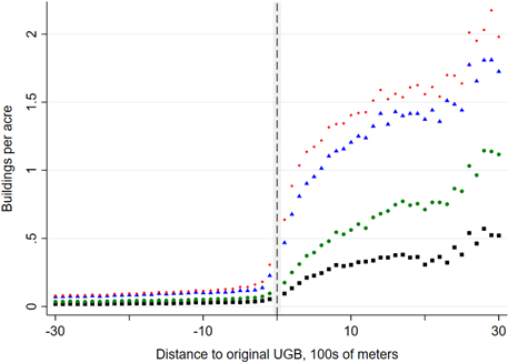
As predicted by economic theory and conformed by causal observation, the density of land development is higher closer
to the city center and lower farther away from the city. This is true both before
and after the introduction of the UGB policy. Land development is also higher in later
years.
The key insight from the figure is that prior to the UGB policy, there are very similar
levels of development just to the left and to the right of the boundary, while after
implementing the policy, a development gap emerges at the boundary. This development
gap provides initial evidence that the UGB policy changed the geography of development.
In 2000 and 2020, development is greater closer to the city center (inside the boundary)
and lower farther from the city center (outside the boundary) than would be the case
in the absence of the policy.
The next post in this series will provide further details on our model estimates and
provide context for how we interpret the economic significance of these findings.
This is Part 2 of a Series that examines urban growth boundaries.

Justin Gallagher
Associate Professor
Montana State University is an ADA/EO/AA/Veteran’s Preference Employer and Provider of Educational and Outreach.